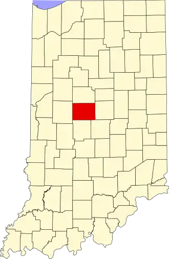
Boone County (Indiana)
| County in de Verenigde Staten | |||
|---|---|---|---|
| |||
| Situering | |||
| Staat | Indiana | ||
| Coördinaten | 40°3'0"NB, 86°28'12"WL | ||
| Algemeen | |||
| Oppervlakte | 1.096 km² | ||
| - land | 1.095 km² | ||
| - water | 1 km² | ||
| Inwoners (2000) |
46.107 (42 inw./km²) | ||
| Overig | |||
| Zetel | Lebanon | ||
| FIPS-code | 18011 | ||
| Opgericht | 1830 | ||
| Website | boonecounty | ||
| Foto's | |||

| |||
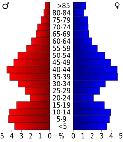 Bevolkingspiramide Boone County | |||
| Statistieken volkstelling Boone County | |||
| |||
Boone County is een county in de Amerikaanse staat Indiana.
De county heeft een landoppervlakte van 1.095 km² en telt 46.107 inwoners (volkstelling 2000). De hoofdplaats is Lebanon.
Bevolkingsontwikkeling
| Jaar | Inwoners | % ± | |
|---|---|---|---|
| 1900 | 26.321 | — | |
| 1910 | 24.673 | −6,3% | |
| 1920 | 23.575 | −4,5% | |
| 1930 | 22.290 | −5,5% | |
| 1940 | 22.081 | −0,9% | |
| 1950 | 23.993 | 8,7% | |
| 1960 | 27.543 | 14,8% | |
| 1970 | 30.870 | 12,1% | |
| 1980 | 36.446 | 18,1% | |
| 1990 | 38.147 | 4,7% | |
| 2000 | 46.107 | 20,9% | |
| Bron: (en) Historical Decennial Census Population | |||