Boldre
| Civil parish in Engeland | |||
|---|---|---|---|
 | |||
| Situering | |||
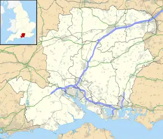
| Regio | South East England | ||
| Graafschap | Hampshire | ||
| District | New Forest | ||
| Coördinaten | 50° 47' NB, 1° 33' WL | ||
| Algemeen | |||
| Oppervlakte | 23,1423 km² | ||
| Inwoners (2011) |
2003 (87 inw./km²) | ||
| Overig | |||
| Postcode(s) | SO42 | ||
| Netnummer(s) | 01590 | ||
| Grid code | SZ3158698154 | ||
| Post town | LYMINGTON | ||
| ONS-code | E04004556 | ||
| Foto's | |||
| |||
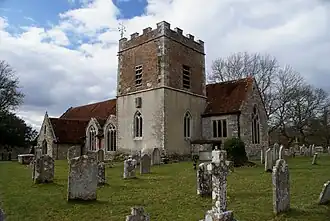
| Johannes-de-Doper-kerk. | |||
| |||
Boldre is een civil parish in het bestuurlijke gebied New Forest, in het Engelse graafschap Hampshire.
Geplaatst op:
3-8-2010
3-8-2010
Dit artikel is een beginnetje over landen & volken. U wordt uitgenodigd om op bewerken te klikken om uw kennis aan dit artikel toe te voegen.