Boissy-lès-Perche
| Gemeente in Frankrijk | |||
|---|---|---|---|
 | |||
| Situering | |||
| Regio | Centre-Val de Loire | ||
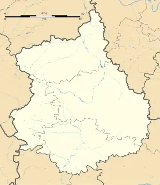
| Departement | Eure-et-Loir (28) | ||
| Arrondissement | Dreux | ||
| Kanton | Saint-Lubin-des-Joncherets | ||
| Coördinaten | 48° 41′ NB, 0° 54′ OL | ||
| Algemeen | |||
| Oppervlakte | 33,66 km² | ||
| Inwoners (1 januari 2022) |
495[1] (15 inw./km²) | ||
| Hoogte | 165 - 233 m | ||
| Overig | |||
| Postcode | 28340 | ||
| INSEE-code | 28046 | ||
| Website | Officiële website | ||
| Detailkaart | |||
 | |||
| Foto's | |||
| |||
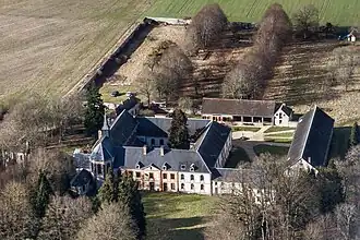
| Luchtfoto van Cour Pétral, voormalig cisterciënzerklooster | |||
| |||
Boissy-lès-Perche is een gemeente in het Franse departement Eure-et-Loir (regio Centre-Val de Loire) en telt 525 inwoners (2005). De plaats maakt deel uit van het arrondissement Dreux.
Geografie
De oppervlakte van Boissy-lès-Perche bedraagt 34,2 km², de bevolkingsdichtheid is 15,4 inwoners per km².
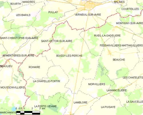
De onderstaande kaart toont de ligging van Boissy-lès-Perche met de belangrijkste infrastructuur en aangrenzende gemeenten.
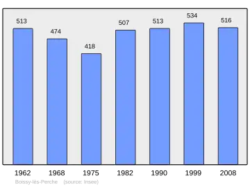
Demografie
Onderstaande figuur toont het verloop van het inwonertal (bron: INSEE-tellingen).
Externe links
- (fr) Statistische informatie op de website van het Franse bureau voor statistiek INSEE
Zie de categorie Boissy-lès-Perche van Wikimedia Commons voor mediabestanden over dit onderwerp.
- ↑ Populations de référence 2022.