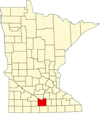
Blue Earth County
| County in de Verenigde Staten | |||
|---|---|---|---|
| |||
| Situering | |||
| Staat | Minnesota | ||
| Coördinaten | 44°1'48"NB, 94°3'36"WL | ||
| Algemeen | |||
| Oppervlakte | 1.984 km² | ||
| - land | 1.949 km² | ||
| - water | 35 km² | ||
| Inwoners (2000) |
55.941 (29 inw./km²) | ||
| Overig | |||
| Zetel | Mankato | ||
| FIPS-code | 27013 | ||
| Opgericht | 1853 | ||
| Website | www | ||
| Foto's | |||

| |||
 Bevolkingspiramide Blue Earth County | |||
| Statistieken volkstelling Blue Earth County | |||
| |||
Blue Earth County is een county in de Amerikaanse staat Minnesota.
De county heeft een landoppervlakte van 1.949 km² en telt 55.941 inwoners (volkstelling 2000). De hoofdplaats is Mankato.
Bevolkingsontwikkeling
| Jaar | Inwoners | % ± | |
|---|---|---|---|
| 1900 | 32.263 | — | |
| 1910 | 29.337 | −9,1% | |
| 1920 | 31.477 | 7,3% | |
| 1930 | 33.847 | 7,5% | |
| 1940 | 36.203 | 7,0% | |
| 1950 | 38.327 | 5,9% | |
| 1960 | 44.385 | 15,8% | |
| 1970 | 52.322 | 17,9% | |
| 1980 | 52.314 | −0,0% | |
| 1990 | 54.044 | 3,3% | |
| 2000 | 55.941 | 3,5% | |
| Bron: (en) Historical Decennial Census Population | |||