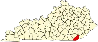
Bell County (Kentucky)
| County in de Verenigde Staten | |||
|---|---|---|---|
| |||
| Situering | |||
| Staat | Kentucky | ||
| Coördinaten | 36°44'24"NB, 83°40'12"WL | ||
| Algemeen | |||
| Oppervlakte | 936 km² | ||
| - land | 934 km² | ||
| - water | 2 km² | ||
| Inwoners (2000) |
30.060 (32 inw./km²) | ||
| Overig | |||
| Zetel | Pineville | ||
| FIPS-code | 21013 | ||
| Opgericht | 1867 | ||
| Website | www | ||
| Foto's | |||

| |||
 Bevolkingspiramide Bell County | |||
| Statistieken volkstelling Bell County | |||
| |||
Bell County is een county in de Amerikaanse staat Kentucky.
De county heeft een landoppervlakte van 934 km² en telt 30.060 inwoners (volkstelling 2000). De hoofdplaats is Pineville en de dichtstbevolkte stad is Middlesboro.
Bevolkingsontwikkeling
| Jaar | Inwoners | % ± | |
|---|---|---|---|
| 1900 | 15.701 | — | |
| 1910 | 28.447 | 81,2% | |
| 1920 | 33.988 | 19,5% | |
| 1930 | 38.747 | 14,0% | |
| 1940 | 43.812 | 13,1% | |
| 1950 | 47.602 | 8,7% | |
| 1960 | 35.336 | −25,8% | |
| 1970 | 31.087 | −12,0% | |
| 1980 | 34.330 | 10,4% | |
| 1990 | 31.506 | −8,2% | |
| 2000 | 30.060 | −4,6% | |
| Bron: (en) Historical Decennial Census Population | |||