Barton County (Kansas)
| County in de Verenigde Staten | |||
|---|---|---|---|
| |||
| Situering | |||
| Staat | Kansas | ||
| Coördinaten | 38°28'0,1"NB, 98°46'0,1"WL | ||
| Algemeen | |||
| Oppervlakte | 2.332 km² | ||
| - land | 2.315 km² | ||
| - water | 17 km² | ||
| Inwoners (2000) |
28.205 (12 inw./km²) | ||
| Overig | |||
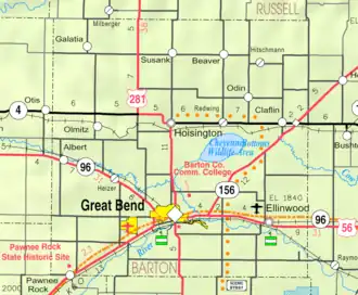
| Zetel | Great Bend | ||
| FIPS-code | 20009 | ||
| Opgericht | 1867 | ||
| Website | bartoncounty | ||
| Detailkaart | |||
| |||
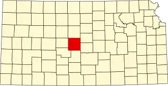
| Overzichtskaart van Barton County | |||
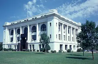
| Foto's | |||
| |||
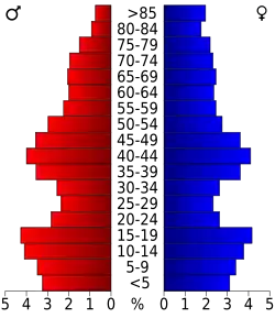 Bevolkingspiramide Barton County | |||
| Statistieken volkstelling Barton County | |||
| |||
Barton County is een county in de Amerikaanse staat Kansas.
De county heeft een landoppervlakte van 2.315 km² en telt 28.205 inwoners (volkstelling 2000). De hoofdplaats is Great Bend.
Bevolkingsontwikkeling
| Jaar | Inwoners | % ± | |
|---|---|---|---|
| 1900 | 13.784 | — | |
| 1910 | 17.876 | 29,7% | |
| 1920 | 18.422 | 3,1% | |
| 1930 | 19.776 | 7,3% | |
| 1940 | 25.010 | 26,5% | |
| 1950 | 29.909 | 19,6% | |
| 1960 | 32.368 | 8,2% | |
| 1970 | 30.663 | −5,3% | |
| 1980 | 31.343 | 2,2% | |
| 1990 | 29.382 | −6,3% | |
| 2000 | 28.205 | −4,0% | |
| Bron: (en) Historical Decennial Census Population | |||