Barrow-in-Furness
| Niet-metropolitaans district in Engeland | |||
|---|---|---|---|
 | |||
| |||
| Situering | |||
| Land | Engeland | ||
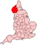
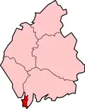
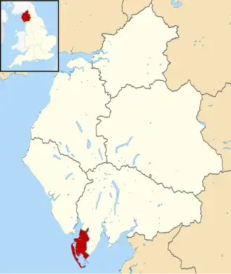
| County | Cumbria | ||
| Regio | North West England | ||
| Coördinaten | 54°8'NB, 3°12'WL | ||
| Algemeen | |||
| Oppervlakte | 77,9754[1] km² | ||
| Inwoners (2018[2]) |
67.137 (861 inw./km²) | ||
| ONS-code | E07000027 | ||
| Website | www | ||
| Detailkaart | |||
| |||
| Foto's | |||
| |||
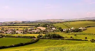
| Semi-rural Newton-in-Furness | |||
| |||
De Borrough of Barrow-in-Furness is een Engels district in het graafschap Cumbria en telde in 2018 ruim 67.000 inwoners. De oppervlakte bedraagt 78 km². Hoofdplaats is het gelijknamige Barrow-in-Furness met 69.100 inwoners (2011).
Van de bevolking is 16,7% ouder dan 65 jaar. De werkloosheid bedraagt 4,2% van de beroepsbevolking (cijfers volkstelling 2001).
Civil parishes in district Barrow-in-Furness
Bronnen, noten en/of referenties
- ↑ Office for National Statistics → Download → SAM_for_Administrative_Areas_(2018).zip → SAM_LAD_DEC_2018_UK.xlsx.
- ↑ https://www.ons.gov.uk/file?uri=/peoplepopulationandcommunity/populationandmigration/populationestimates/datasets/populationestimatesforukenglandandwalesscotlandandnorthernireland/mid20182019laboundaries/ukmidyearestimates20182019ladcodes.xls Schatting Office for National Statistics: knop MYE5 → kolom Estimated Population mid-2018]