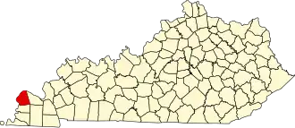
Ballard County
| County in de Verenigde Staten | |||
|---|---|---|---|
| |||
| Situering | |||
| Staat | Kentucky | ||
| Coördinaten | 37°3'36"NB, 89°0'0"WL | ||
| Algemeen | |||
| Oppervlakte | 709 km² | ||
| - land | 651 km² | ||
| - water | 58 km² | ||
| Inwoners (2000) |
8.286 (13 inw./km²) | ||
| Overig | |||
| Zetel | Wickliffe | ||
| FIPS-code | 21007 | ||
| Opgericht | 1842 | ||
| Website | ballardcounty | ||
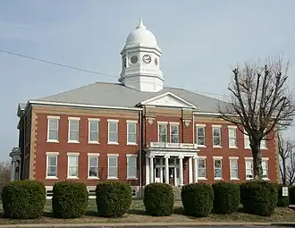
| Foto's | |||
| |||
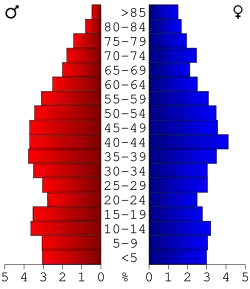 Bevolkingspiramide Ballard County | |||
| Statistieken volkstelling Ballard County | |||
| |||
Ballard County is een county in de Amerikaanse staat Kentucky.
De county heeft een landoppervlakte van 651 km² en telt 8.286 inwoners (volkstelling 2000). De hoofdplaats is Wickliffe en de dichtstbevolkte stad is LaCenter.
Bevolkingsontwikkeling
| Jaar | Inwoners | % ± | |
|---|---|---|---|
| 1900 | 10.761 | — | |
| 1910 | 12.690 | 17,9% | |
| 1920 | 12.045 | −5,1% | |
| 1930 | 9.910 | −17,7% | |
| 1940 | 9.480 | −4,3% | |
| 1950 | 8.545 | −9,9% | |
| 1960 | 8.291 | −3,0% | |
| 1970 | 8.276 | −0,2% | |
| 1980 | 8.798 | 6,3% | |
| 1990 | 7.902 | −10,2% | |
| 2000 | 8.286 | 4,9% | |
| Bron: (en) Historical Decennial Census Population | |||
Zie de categorie Ballard County, Kentucky van Wikimedia Commons voor mediabestanden over dit onderwerp.