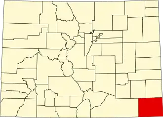
Baca County
| County in de Verenigde Staten | |||
|---|---|---|---|
| |||
| Situering | |||
| Staat | Colorado | ||
| Coördinaten | 37°19'12"NB, 102°33'36"WL | ||
| Algemeen | |||
| Oppervlakte | 6.623 km² | ||
| - land | 6.619 km² | ||
| - water | 4 km² | ||
| Inwoners (2000) |
4.517 (1 inw./km²) | ||
| Overig | |||
| Zetel | Springfield | ||
| FIPS-code | 08009 | ||
| Opgericht | 1889 | ||
| Website | bacacountyco | ||
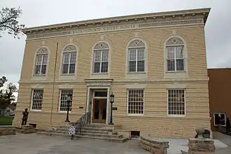
| Foto's | |||
| |||
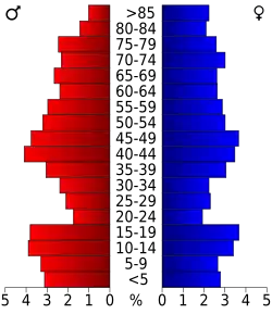 Bevolkingspiramide Baca County | |||
| Statistieken volkstelling Baca County | |||
| |||
Baca County is een county in de Amerikaanse staat Colorado.
De county heeft een landoppervlakte van 6.619 km² en telt 4.517 inwoners (volkstelling 2000). De hoofdplaats is Springfield.
Bevolkingsontwikkeling
| Jaar | Inwoners | % ± | |
|---|---|---|---|
| 1900 | 759 | — | |
| 1910 | 2.516 | 231,5% | |
| 1920 | 8.721 | 246,6% | |
| 1930 | 10.570 | 21,2% | |
| 1940 | 6.207 | −41,3% | |
| 1950 | 7.964 | 28,3% | |
| 1960 | 6.310 | −20,8% | |
| 1970 | 5.674 | −10,1% | |
| 1980 | 5.419 | −4,5% | |
| 1990 | 4.556 | −15,9% | |
| 2000 | 4.517 | −0,9% | |
| Bron: (en) Historical Decennial Census Population | |||