Arapahoe County
| County in de Verenigde Staten | |||
|---|---|---|---|
| |||
| Situering | |||
| Staat | Colorado | ||
| Coördinaten | 39°38'24"NB, 104°19'48"WL | ||
| Algemeen | |||
| Oppervlakte | 2.086 km² | ||
| - land | 2.080 km² | ||
| - water | 6 km² | ||
| Inwoners (2000) |
487.967 (235 inw./km²) | ||
| Overig | |||
| Zetel | Littleton | ||
| FIPS-code | 08005 | ||
| Opgericht | 1861 | ||
| Website | www | ||
| Detailkaart | |||
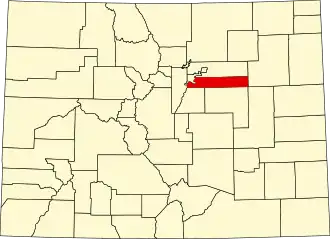
| Overzichtskaart van Arapahoe County | |||
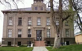
| Foto's | |||
| |||
 Bevolkingspiramide Arapahoe County | |||
| Statistieken volkstelling Arapahoe County | |||
| |||
Arapahoe County is een county in de Amerikaanse staat Colorado.
De county heeft een landoppervlakte van 2.080 km² en telt 487.967 inwoners (volkstelling 2000). De hoofdplaats is Littleton.
Bevolkingsontwikkeling
| Jaar | Inwoners | % ± | |
|---|---|---|---|
| 1900 | 153.017 | — | |
| 1910 | 10.263 | −93,3% | |
| 1920 | 13.766 | 34,1% | |
| 1930 | 22.647 | 64,5% | |
| 1940 | 32.150 | 42,0% | |
| 1950 | 52.125 | 62,1% | |
| 1960 | 113.426 | 117,6% | |
| 1970 | 162.142 | 42,9% | |
| 1980 | 293.621 | 81,1% | |
| 1990 | 391.511 | 33,3% | |
| 2000 | 487.967 | 24,6% | |
| Bron: (en) Historical Decennial Census Population | |||