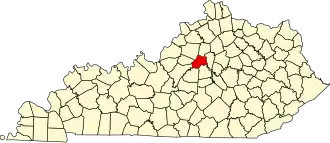
Anderson County (Kentucky)
| County in de Verenigde Staten | |||
|---|---|---|---|
| |||
| Situering | |||
| Staat | Kentucky | ||
| Coördinaten | 38°0'0"NB, 84°59'24"WL | ||
| Algemeen | |||
| Oppervlakte | 529 km² | ||
| - land | 525 km² | ||
| - water | 4 km² | ||
| Inwoners (2000) |
19.111 (36 inw./km²) | ||
| Overig | |||
| Zetel | Lawrenceburg | ||
| FIPS-code | 21005 | ||
| Opgericht | 1827 | ||
| Website | www | ||
| Foto's | |||

| |||
 Bevolkingspiramide Anderson County | |||
| Statistieken volkstelling Anderson County | |||
| |||
Anderson County is een county in de Amerikaanse staat Kentucky.
De county heeft een landoppervlakte van 525 km² en telt 19.111 inwoners (volkstelling 2000). De hoofdplaats is Lawrenceburg.
Bevolkingsontwikkeling
| Jaar | Inwoners | % ± | |
|---|---|---|---|
| 1900 | 10.051 | — | |
| 1910 | 10.146 | 0,9% | |
| 1920 | 9.982 | −1,6% | |
| 1930 | 8.494 | −14,9% | |
| 1940 | 8.936 | 5,2% | |
| 1950 | 8.984 | 0,5% | |
| 1960 | 8.618 | −4,1% | |
| 1970 | 9.358 | 8,6% | |
| 1980 | 12.567 | 34,3% | |
| 1990 | 14.571 | 15,9% | |
| 2000 | 19.111 | 31,2% | |
| Bron: (en) Historical Decennial Census Population | |||