Anderson County (Kansas)
| County in de Verenigde Staten | |||
|---|---|---|---|
| |||
| Situering | |||
| Staat | Kansas | ||
| Coördinaten | 38°12'NB, 95°18'WL | ||
| Algemeen | |||
| Oppervlakte | 1.514 km² | ||
| - land | 1.510 km² | ||
| - water | 4 km² | ||
| Inwoners (2000) |
8.110 (5 inw./km²) | ||
| Overig | |||
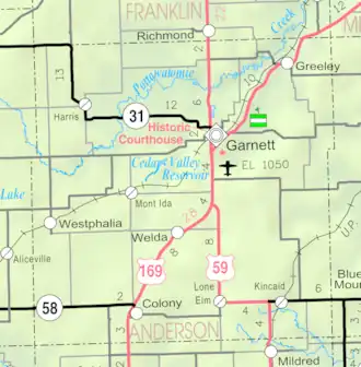
| Zetel | Garnett | ||
| FIPS-code | 20003 | ||
| Opgericht | 1855 | ||
| Website | andersoncountyks | ||
| Detailkaart | |||
| |||
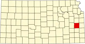
| Overzichtskaart van Anderson County | |||
| Foto's | |||

| |||
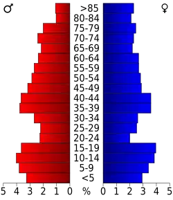 Bevolkingspiramide Anderson County | |||
| Statistieken volkstelling Anderson County | |||
| |||
Anderson County is een county in de Amerikaanse staat Kansas.
De county heeft een landoppervlakte van 1.510 km² en telt 8.110 inwoners (volkstelling 2000). De hoofdplaats is Garnett.
Bevolkingsontwikkeling
| Jaar | Inwoners | % ± | |
|---|---|---|---|
| 1900 | 13.938 | — | |
| 1910 | 13.829 | −0,8% | |
| 1920 | 12.986 | −6,1% | |
| 1930 | 13.355 | 2,8% | |
| 1940 | 11.658 | −12,7% | |
| 1950 | 10.267 | −11,9% | |
| 1960 | 9.035 | −12,0% | |
| 1970 | 8.501 | −5,9% | |
| 1980 | 8.749 | 2,9% | |
| 1990 | 7.803 | −10,8% | |
| 2000 | 8.110 | 3,9% | |
| Bron: (en) Historical Decennial Census Population | |||